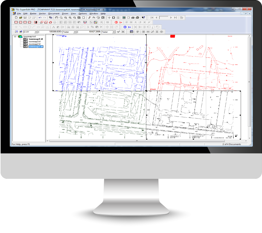
Standalone hybrid editor for scanned maps, raster and vector drawings
SuperEdit offers advanced functions to edit full size raster images originating from regular or large scale scanners. SuperEdit shares editing capabilities with CADRaster and can be used by customers that do not use AutoCAD. Additionally SuperEdit provides basic tools for creating vector drawings.
Additionally SuperEdit provides multi-layered fully featured structure for creating and editing of vector entities using tools similar to other popular drafting systems.
SuperEdit is excellent tool to correct defects introduced by the source material or scanning process. After that you can use scanned images as background to new designs, vectorize image contents or modify image to bring documents up to date.
The technology of Composite Documents designed and developed by Tessel Systems is a very comfortable and useful way of simultaneous presentation of many raster and vector documents as a one document.
Any Drawing Size
Work fast on any size of the drawingCalibration
Distorted drawings can be esily fixedMeasure
Measure distance and areaSupport for geographical coordinates in five most popular geographical mappings:
Key features
Basic features (LTX & PRO)
- raster editing commands for raster images include move, crop, clear rectangle and polygon, align, rotate and resize independently in X & Y directions
- multiple UNDO/REDO of raster editing operations
- multi-point calibration with full graphical and numerical session control
- cut/copy/paste editing of raster images
- tools for viewing and editing raster transparency
- interactive raster trace function giving optimized polylines with automatic line width recognition
- raster split function to convert very large raster images to manageable composite documents
- SuperEdit can editing images stored in fourteen different raster formats like TIFF, GIF, PCX, BMP, CALS, CIT
Features available in the PRO version only
- editing color images
- multi-point calibration with full graphical and numerical session control
- mixing selective and permanent raster snaps inside SuperEdit’s commands
- cut/copy/paste editing of raster images
- inserting vectors to raster backgrounds and rasterizing complete vector drawings
- interactive raster trace function giving optimized polylines with automatic line width recognition
- editing of image transparency information
- displaying geographical coordinates
- raster split function to convert very large raster images to manageable composite documents
Support for vector drawings in SuperEdit include the following features
- multiple Tessel Vector Document (TVD) accessible in TCD documents
- wide set of basic vector entities includes: point, segment, rectangle, circle, circular arc, ellipse, polygon, polyline, text and predefined complex entities
- vector editing commands include move, rotate and resize independently in X & Y directions blocks and complexes associating together the basic entities
- cut/copy/paste editing of vector entities
- import and export in DXF

